North Dakota
| State of North Dakota | |||||||||||
| |||||||||||
| Official language(s) | English[1] | ||||||||||
| Capital | Bismarck | ||||||||||
| Largest city | Fargo | ||||||||||
| Area | Ranked 19th | ||||||||||
| - Total | 70,700 sq mi (183,272 km²) | ||||||||||
| - Width | 210 miles (340 km) | ||||||||||
| - Length | 340 miles (545 km) | ||||||||||
| - % water | 2.4 | ||||||||||
| - Latitude | 45° 56′ N to 49° 00′ N | ||||||||||
| - Longitude | 96° 33′ W to 104° 03′ W | ||||||||||
| Population | Ranked 48th in the U.S. | ||||||||||
| - Total | 683,932 (2011 est)[2] | ||||||||||
| - Density | 9.92/sq mi (3.83/km2) Ranked 47th in the U.S. | ||||||||||
| Elevation | |||||||||||
| - Highest point | White Butte[3][4] 3,508 ft (1069 m) | ||||||||||
| - Mean | 1,900 ft (580 m) | ||||||||||
| - Lowest point | Red River of the North | ||||||||||
| Admission to Union | November 2, 1889[a] (39th) | ||||||||||
| Governor | Jack Dalrymple (R) | ||||||||||
| Lieutenant Governor | Drew Wrigley (R) | ||||||||||
| U.S. Senators | Kent Conrad (D) John Hoeven (R) | ||||||||||
| Time zones | |||||||||||
| - most of state | Central: UTC-6/-5 | ||||||||||
| - southwest | Mountain: UTC-7/-6 | ||||||||||
| Abbreviations | ND US-ND | ||||||||||
| Web site | www.nd.gov | ||||||||||
North Dakota is a state located in the Midwestern and Western regions of the United States of America. The twelfth-largest state by area in the U.S., it is the 48th most populous, with just over 640,000 residents as of 2006. North Dakota was carved out of the northern half of the Dakota Territory and admitted to the Union as the 39th state on November 2, 1889, sharing the same day of new statehood with the state of South Dakota.
The Missouri River flows through the western part of the state and forms Lake Sakakawea behind the Garrison Dam. The western half of the state is hilly and contains lignite coal and oil. In the east, the Red River forms the Red River Valley, holding fertile farmland. Agriculture has long dominated the economy and culture of North Dakota.
The state capital is Bismarck, and the largest city in the state is Fargo. The primary public universities are located in Grand Forks and Fargo. The United States Air Force operates bases at both Minot and Grand Forks.
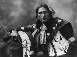
Like the entire western region of the United States, North Dakota has a history deeply interlinked with that of many Native American tribes or First Nations peoples. The original nomadic tribes of the Great Plains were eventually joined by the Sioux and Chippewa tribes.
Etymology
North Dakota is named for the Dakota Indian tribes. The names used by the Dakotas themselves for their various tribal groups were Dakota, Nakota and Lakota. Dakota were also referred to as Sioux by the French. From their language the word dakota meant "allies" or "friends." The Dakota tribes were originally from the region around Lake Superior and were not the original tribes inhabiting the Dakota territory. They migrated westward from the region around Lake Superior after the advent of French fur traders.
Geography
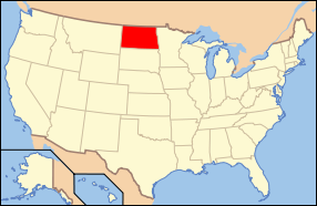
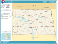
North Dakota is considered to be in the U.S. regions known as the Upper Midwest and the Great Plains. The state shares the Red River of the North with Minnesota on the east; South Dakota is to the south, Montana is to the west, and the Canadian provinces of Saskatchewan and Manitoba adjoin North Dakota on its northern border.
With 70,762 square miles (183,273 sq km), North Dakota is the 19th largest state in the U.S.
The western half of the state consists of the hilly Great Plains, and the northern part of the Badlands to the west of the Missouri River. The state's high point, White Butte at 3506 feet (1069 m), and Theodore Roosevelt National Park are located in the Badlands. The region is abundant in fossil fuels including crude oil and lignite coal. The Missouri River forms Lake Sakakawea, the third largest man-made lake in the United States, behind the Garrison Dam.
The central region of the state is divided into the Drift Prairie and the Missouri Plateau. This area is covered in lakes, slough, and rolling hills. The Turtle Mountains are located along the Manitoba border. The geographic center of the North American continent is located near the city of Rugby.
The eastern part of the state consists of the flat Red River Valley, the bottom of glacial Lake Agassiz. Its fertile soil, drained by the meandering Red River flowing northward into Lake Winnipeg, supports a large agriculture industry. The Red River forms the eastern border of North Dakota with Minnesota. Devil's Lake, the largest natural lake in the state, is also found in the east.
Vegetation and Wildlife
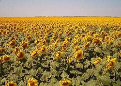
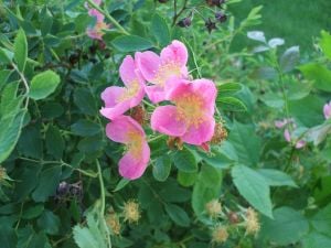
North Dakota is not known for its abundance of trees since so much of the land was originally native grasslands prairie. To this day the wide open treeless spaces are common in most of the state where farming and ranching takes place. Along the Missouri and other rivers Giant Cottonwood trees thrive and elm, green ash, quaking aspen, birch and oak can be found in the Turtle Mountains or the Pembina Gorge region. Hundreds of species of wildflowers thrive throughout North Dakota.
Due to the availability of marshes and grasslands, meadow birds abound. The Western Meadowlark, the state bird, is very common and its melodic song makes it easy to recognize. Waterfowl migrate through the state in spring and fall. Large Birds of prey such as hawk, eagles and vultures thrive well here. Moose, deer and many smaller mammals such as Coyotes, badgers, rabbit, fox, squirrels and beaver also live in this vast domain of relatively unpopulated land. The black-tailed prairie dog is considered a nuisance, causing grief for farmers and ranchers alike as they tunnel into fields where animals graze and crops are grown.
Climate
North Dakota endures temperature extremes characteristic of its continental climate; with cold winters and hot summers, the record high and low spanning 181 °F (83 °C). [5] Meteorological events include rain, snow, hail, blizzards, polar fronts, tornados, thunderstorms, and high-velocity straight-line winds. Depending on location, average annual precipitation ranges from 14 in (35.6 cm) to 22 in (55.9 cm).
Springtime flooding is a relatively common event in the Red River Valley, due to the river flowing north into Canada. The spring melt and the eventual runoff typically begins earlier in the southern part of the valley than in the northern part. [6] The most destructive flooding in eastern North Dakota occurred in 1997, which caused extensive damage to Grand Forks.[7]
History
Prior to European contact, Native Americans inhabited North Dakota for thousands of years. The first European to reach the area was the French-Canadian trader La Vérendrye, who led an exploration party to Mandan villages in 1738. [8] The trading arrangement between tribes was such that North Dakota tribes rarely dealt directly with Europeans. However, the native tribes were in sufficient contact that by the time that Lewis and Clark entered North Dakota in 1804, they were aware of the French and then Spanish claims to their territory.[9]
Much of present-day North Dakota was included in the Louisiana Purchase of 1803. Much of the acquired land was organized into Minnesota and Nebraska Territories. Dakota Territory, making up present-day North and South Dakota, along with parts of present-day Wyoming and Montana, was organized on March 2, 1861. [10] Dakota Territory was settled sparsely until the late 1800s, when the railroads entered the region and aggressively marketed the land. A bill for statehood for North Dakota, South Dakota, Montana, and Washington titled the Enabling Act of 1889 was passed on February 22, 1889 during the administration of Grover Cleveland. After Cleveland's death, it was left to his successor, Benjamin Harrison, to sign proclamations formally admitting North and South Dakota to the Union on November 2, 1889. [11]
The rivalry between the two new states presented a dilemma of which was to be admitted first. Harrison directed Secretary of State James G. Blaine to shuffle the papers and obscure from him which he was signing first and the actual order went unrecorded. However, since North Dakota alphabetically appears before South Dakota, its proclamation was published first in the Statutes At Large. Since that day, it has become common to list the Dakotas alphabetically and thus North Dakota is usually listed as the 39th state.
Corruption in the early territorial and state governments led to a wave of populism, led by the Non Partisan League, that brought social reforms in the early 20th century. The original North Dakota State Capitol burned to the ground on December 28, 1930, and was replaced by a limestone faced art deco skyscraper that still stands today.
One of the chapters in the modern history of North Dakota defines the people who live there today. In the 1930s the Great Depression had its greatest impact on the region of the Great Plains of which North Dakota was a central area. The dust bowl was an apt phrase of what was left behind after wild climate abnormalities and plagues of vermin decimated crops while the worldwide economy went into depression. Starvation and dire poverty was no stranger to those who persevered through the hard times of the dirty thirties. Tens of thousands of North Dakotans left during the Great Depression, never to return. Survival was harsh during this time of hardship and the people who remained formed the backbone of the culture of North Dakota today.
A round of federal construction projects began in the 1950s including the Garrison Dam, and the Minot and Grand Forks Air Force bases. [12] There was a boom in oil exploration in western North Dakota in the 1980s, as rising petroleum prices made development profitable. [13]
Law and government
North Dakota has a bicameral legislature. The state elects two House Representatives and one Senator from each of 47 districts apportioned by population. The legislature meets at the North Dakota State Capitol in an 80-day regular session in odd-numbered years, and in special session if summoned by the governor.
North Dakota's judiciary has a two-tier structure. Each of the 53 counties has a court, from which appeals are sent directly to the North Dakota Supreme Court. Because of the expense of having each county hire a judge, and the fairly low workload in smaller counties, the state is divided into seven judicial districts which collectively elect judges to travel to the various courthouses and hear cases.
District Judges are elected to six-year terms. Supreme Court Judges are elected to ten-year terms. The Supreme Court Chief Justice is selected every five years by vote of the District and Supreme Court Judges.
North Dakota's codified law is called the North Dakota Century Code (NDCC).
Politics
The major political parties in North Dakota are the Republican Party and the Democratic-NPL Party. North Dakota does have some third parties, but aside from Presidential nominations, none have fielded state office candidates for some time.
At the state level, the governorship has been held by the Republican Party since 1992, along with a majority of the state legislature and statewide officers. Dem-NPL showings were strong in the 2000 governor's race, and in the 2006 legislative elections, but the League has not had a major breakthrough since the administration of former state governor George Sinner.
The Republican Party presidential candidate usually carries the state; in 2004, George W. Bush won with 62.9 percent of the vote. Of all the Democratic presidential candidates since 1892, only Grover Cleveland, Woodrow Wilson, Franklin Delano Roosevelt, and Lyndon Baines Johnson received Electoral College votes from North Dakota.
On the other hand, Dem-NPL candidates for North Dakota's federal Senate and Congressional seats have won every election since 1982, and the state's federal delegation has been entirely Democratic since 1986.
Economy
The U.S. Bureau of Economic Analysis estimates that North Dakota's total state product in 2005 was $24.178 billion. Per capita personal income in 2005 was $31,395. This ranks the state 32nd in the nation.
North Dakota leads the nation in production of several crops. Agricultural activity is largely dependent on rainfall. Wheat (particularly the durum variety used for pasta), barley, canola, soybeans, sunflowers, and flax are present throughout the state. The wetter Red River Valley is dominated by farms, with the chief crops being sugar beets, soybeans and corn. Cattle ranches are more common in the dry southwest, though dairy ranches are more common toward the east. Honey is produced in the central part of the state. Small quantities of juneberries and grapes support a modest domestic winery industry.
The state's relatively small industrial output includes electric power, food processing, machinery, lignite mining, petroleum extraction, and tourism.
North Dakota has the only state-owned bank in the United States, the Bank of North Dakota. The bank, by law, holds all funds of all state and local government agencies in North Dakota. Its deposits are not guaranteed by the Federal Deposit Insurance Corporation but by the state itself. The state also operates the only state-owned mill in the country, the North Dakota Mill and Elevator.
North Dakota's reputation for severe weather has been cited by many as a motivating factor behind emigration and the failure of outside industry to locate in the state, though some have found this to be a secondary factor to the overall economic situation in the state.
State income taxes are collected through five different tax brackets, ranging from 2.1 percent to 5.54 percent. North Dakota allows a credit for the net amount of tax paid to another state on income that is subject to tax by both North Dakota and that other state. North Dakota's sales tax rate is five percent. Local subdivisions are also allowed to levy a sales and use tax. This tax rate generally ranges from one percent to three percent. For the most part, personal property is exempt from property tax.
Transportation
The major east-west highways are US 2 and Interstate 94. North Dakota Highways 5 and 200 are also significant east-west routes.
The major north-south highways are Interstate 29, US 81, US 281, US 83, and US 85.
In June 2007, North Dakota was ranked No. 1 for the best Interstates and Highways in the Nation. The study, done by Los Angeles-based Reason Foundation, ran numerous tests such as traffic congestion, road quality and maintenance. Other top ranking states include South Carolina, Kansas, New Mexico and Montana.
US 52 runs northwest-southeast from Portal to Jamestown, then to Fargo via I-94. US 12 cuts across the southwest corner of the state, intersecting US 85 in Bowman.
The Burlington Northern Santa Fe Railroad BNSF and the Canadian Pacific Railway (CP) operate the most extensive rail systems in the state. Minor lines include the Dakota, Missouri Valley and Western Railroad and the Red River Valley and Western Railroad, mostly operating on leased branch lines that the BNSF and CP were planning to abandon.
North Dakota has 90 public airports of which eight are major commercial airports. In addition to the public airports there are also a few hundred landing strips privately owned by farmers and ranchers who have their own private aircraft for traveling the long distances that must be covered between cities and towns and for other uses such as crop dusting.
Education
North Dakota's leaders frequently state that the educational scene in the state is excellent. However, because of limited economic options, many skilled graduates leave the state.
Higher education
The state has 11 public colleges and universities, five tribal community colleges, and four private schools. The largest institutions are the University of North Dakota and North Dakota State University.
The higher education system consists of the following institutions:
North Dakota University System (Public schools):
- University of North Dakota—Founded by the Dakota Territorial Assembly in 1883, six years before statehood, it is one of only 47 public universities with both accredited law and medical schools. UND’s economic impact on the state and region is nearly $1 billion a year.
- North Dakota State University—it is a publicly supported comprehensive land-grant institution, with a strong agriculture and applied science tradition.
- North Dakota State College of Science
- Bismarck State College—North Dakota's first two-year city college.
- Dickinson State University
- Lake Region State College
- Mayville State University
- Minot State University
- Minot State University-Bottineau
- Valley City State University
- Williston State College
Tribal colleges:
- Cankdeska Cikana Community College in Fort Totten
- Fort Berthold Community College in New Town
- Sitting Bull College in Fort Yates
- Turtle Mountain Community College in Belcourt
- United Tribes Technical College in Bismarck
Private schools:
- Aakers College in Fargo and Bismarck
- Jamestown College in Jamestown
- University of Mary in Bismarck
- Trinity Bible College in Ellendale
Demographics
Population
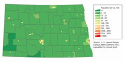
From fewer than 3,000 people in 1870, North Dakota's population grew to near 680,000 by 1930. Growth then slowed, and the population has fluctuated slightly over the next seven decades, hitting a low of 619,636 in the 1950 census, with a total of 642,200 in the 2000 census. [14] As of July 1, 2006, the state's population was estimated at 635,867 by the U.S. Census Bureau.[15] The age and gender distributions approximate the national average. Besides Native Americans, North Dakota's minority groups still form a significantly smaller proportion of the population than in the nation as a whole.[16] The center of population of North Dakota is located in Wells County, near Sykeston.[17]
Since the 1990s, North Dakota has experienced virtually constant decline in population, particularly among younger people and young families.[18] One of the major causes of out-migration in North Dakota looms from a lack of skilled jobs for graduates. Some propose the expansion of economic development programs to create skilled and high-tech jobs; however, the effectiveness of such programs has been open to debate. The depopulation of North Dakota's rural areas is a trend that has been seen for decades and will have a great impact on this state since the rural way of life has always been a defining feature of this state. [19]
As the issue is common to several High Plains states, federal politicians have proposed The New Homestead Act of 2007 to encourage living in areas losing population through incentives such as tax breaks.[20]
Race and ancestry
Most North Dakotans are of Northern European descent. The five largest ancestry groups in North Dakota are: German (43.9 percent), Norwegian (30.1 percent), Irish (7.7 percent), Native American (5 percent), Swedish (5 percent).[21]
Several languages other than English are spoken at home: 2.47 percent of the population aged 5 and over speak German at home, while 1.37 percent speak Spanish, according to the 2000 U.S. Census.[22]
The state's racial composition in 2005 was: [23]
- 92.3 percent White (non-Hispanic);
- 5.3 percent Native American/Alaskan Native;
- 1.6 percent Hispanic, a category that includes people of many races;
- 0.1 percent Asian/Pacific Islander;
- 0.1 percent Black (non-Hispanic);
- 0.1 percent mixed race.
Religion
North Dakota has the lowest percentage of non-religious people of any state, and it also has the most churches per capita of any state. [24]
A 2001 survey indicated that 35 percent of North Dakota's population was Lutheran, and 30 percent was Roman Catholic. Other religious groups represented were Methodists (7 percent), Baptists (6 percent), the Assembly of God (3 percent), and Jehovah's Witness (1 percent). Christians with unstated or other denominational affiliations, including other Protestants, totaled 3 percent, bringing the total Christian population to 86 percent. Non-Christian religions, such as Judaism, Islam, Buddhism, and Hinduism, together represented 4 percent of the population. Three percent of respondents answered "no religion" on the survey, and 6 percent gave no response. [25]
Miscellaneous topics
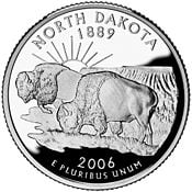
| 'North Dakota state symbols' |
|
Important cities and towns
By population, the ten largest urban centers in the state are:
- Fargo/West Fargo
- Bismarck/Mandan
- Grand Forks
- Minot
- Dickinson
- Jamestown
- Williston
- Wahpeton
- Devils Lake
- Valley City
The population trends in the state are noting a distinct shift from the rural areas to the larger cities. Most of North Dakota's largest communities grew between 1990 and 2000.
Between 1990 and 2000, the U.S. as a whole grew by 13.1 percent, yet North Dakota grew a mere 0.5 percent. It is the only state (along with Washington, DC) whose population declined (by 1.3 percent) between April 1, 2000 and July 1, 2003; this decline has become a major political issue.
"The Flickertail State" is one of North Dakota's nicknames and is derived from Richardson's Ground Squirrel (Spermophilus richardsonii), a very common animal in the region. The ground squirrel constantly flicks its tail in a distinctive manner. In 1953, legislation to make the ground squirrel the state emblem was voted down in the state legislature (S. D. Senate Bill No. 134).
Attractions
Major events
- Big Iron Farm Show - West Fargo
- Fargo Film Festival - Fargo
- Grand Cities Art Fest - Grand Forks
- Norsk Høstfest - Minot
- North Dakota State Fair - Minot
- North Dakota Winter Show - Valley City
Museums
- Bonanzaville, USA - West Fargo
- Dakota Dinosaur Museum - Dickinson
- Dakota Territory Air Museum - Minot
- Fargo Air Museum - Fargo
- Missouri-Yellowstone Confluence Interpretive Center - Williston
- North Dakota Heritage Center - Bismarck
- North Dakota Lewis and Clark Interpretive Center - Washburn
- North Dakota Museum of Art - Grand Forks
- Pembina State Museum - Pembina
- Plains Art Museum - Fargo
- The Roger Maris Museum - Fargo
Various attractions
- Enchanted Highway - Regent
- International Peace Garden - near Dunseith
- Lawrence Welk Homestead - Strasburg
- Medora Musical - Medora
- North Dakota Horse Park - Fargo
- Theodore Roosevelt National Park - near Watford City
Notes
- ↑ North Dakota Century Code, CHAPTER 54-02-13 Retrieved February 16, 2012.
- ↑ Error on call to template:cite web: Parameters url and title must be specified (CSV). 2011 Population Estimates. United States Census Bureau, Population Division (December 2011).
- ↑ 3.0 3.1 Elevations and Distances in the United States. United States Geological Survey (2001). Retrieved October 24, 2011.
- ↑ 4.0 4.1 Elevation adjusted to North American Vertical Datum of 1988.
- ↑ City-Data. North Dakota - Climate. Retrieved November 23, 2007.
- ↑ "Anatomy of a Red River Flood" National Weather Service Weather Forecast Office. accessdate 2007-08-19
- ↑ Alan Draves. 2002 The Grand Forks Flood accessdate 2007-08-20
- ↑ "Audio Transcript of Pierre Gaultier de La Vérendrye, 1738." The Atlas of Canada. 2003. [1]. accessdate 2007-08-19
- ↑ "North Dakota, US" ByRegion Network. 2005. [2] accessdate 2007-08-19.
- ↑ North Dakota Historical Overview: Dakota Territory and Statehood (Northern Great Plains), The Library of Congress. [3] accessdate 2007-08-19
- ↑ "Enabling Act" Washington State Legislature. [4] accessdate 2007-08-19
- ↑ "North Dakota" Timeline. WorldAtlas.com [5] accessdate 2007-08-19
- ↑ "North Dakota History: Overview and Summary." State Historical Society of North Dakota. 1999 [6] accessdate 2007-08-19
- ↑ "North Dakota Historical Population." North Dakota State University [7] accessdate 2007-08-19
- ↑ National and State Population Estimates. Annual Population Estimates 2000 to 2006. US Census Bureau. 2006-12-22
- ↑ [8] North Dakota QuickFacts from the US Census Bureau. accessdate 2007-08-19
- ↑ U.S. Census Bureau 2000.
- ↑ Leading Population Trends in North Dakota. North Dakota State University. 2007 [9] accessdate 2007-08-19
- ↑ Agenda 2003 - Saving North Dakota. The Forum of Fargo-Moorhead. 2002. [10] accessdate 2007-08-19
- ↑ The New Homestead Act of 2007. United States Senator Byron L. Dorgan. [11] accessdate 2007-08-19
- ↑ [12] North Dakota - Selected Social Characteristics. U.S. Census Bureau 2005. accessdate 2007-08-19
- ↑ Most spoken languages in North Dakota. Modern Language Association. [13] accessdate 2007-08-19
- ↑ State Population Estimates by Selected Race Categories: July 1, 2005. U.S. Census Bureau.
- ↑ [14] American Religious Identification Survey. Exhibit 15. The Graduate Center, City University of New York accessdate 2006-11-24
- ↑ Ibid.
ReferencesISBN links support NWE through referral fees
- Silverman, Robin L. From Sea to Shining Sea: North Dakota. Children's Press, Scholastic Inc. (Grolier Publishing Co.) USA, 2003. ISBN 0516223852
- Stock, Catherine McNicol. Main Street in Crisis: The Great Depression and the Old Middle class on the Northern Plains. University of North Carolina Press, 1992. ISBN 0807820113
Further Reading
- Daley, Janet, and Ann M. Rathke. 2000. North Dakota History, journal of the northern plains cumulative index, 1945-1998. Bismarck, ND: State Historical Society of North Dakota. ISBN 1891419196
- Rezatto, Helen. 1989. The Making of the Two Dakotas. Lincoln, Neb: Media Pub. ISBN 0939644606
- Robinson, Elwyn B., D. Jerome Tweton and David B. Danbom. 1995. History of North Dakota. [Fargo]: Institute for Regional Studies, North Dakota State University. ISBN 0911042431
- Vexler, Robert I. 1978. Chronology and Documentary Handbook of the State of North Dakota. Chronologies and documentary handbooks of the States, 34. Dobbs Ferry, N.Y.: Oceana Publications. ISBN 0379161591
- Wilkins, Robert P. and Wynona H. Wilkins. 1977. North Dakota: a Bicentennial History. New York: Norton. ISBN 0393056554
External links
All links retrieved November 16, 2022.
| Political divisions of the United States | |||||||
|---|---|---|---|---|---|---|---|
| |||||||
Credits
New World Encyclopedia writers and editors rewrote and completed the Wikipedia article in accordance with New World Encyclopedia standards. This article abides by terms of the Creative Commons CC-by-sa 3.0 License (CC-by-sa), which may be used and disseminated with proper attribution. Credit is due under the terms of this license that can reference both the New World Encyclopedia contributors and the selfless volunteer contributors of the Wikimedia Foundation. To cite this article click here for a list of acceptable citing formats.The history of earlier contributions by wikipedians is accessible to researchers here:
The history of this article since it was imported to New World Encyclopedia:
Note: Some restrictions may apply to use of individual images which are separately licensed.

