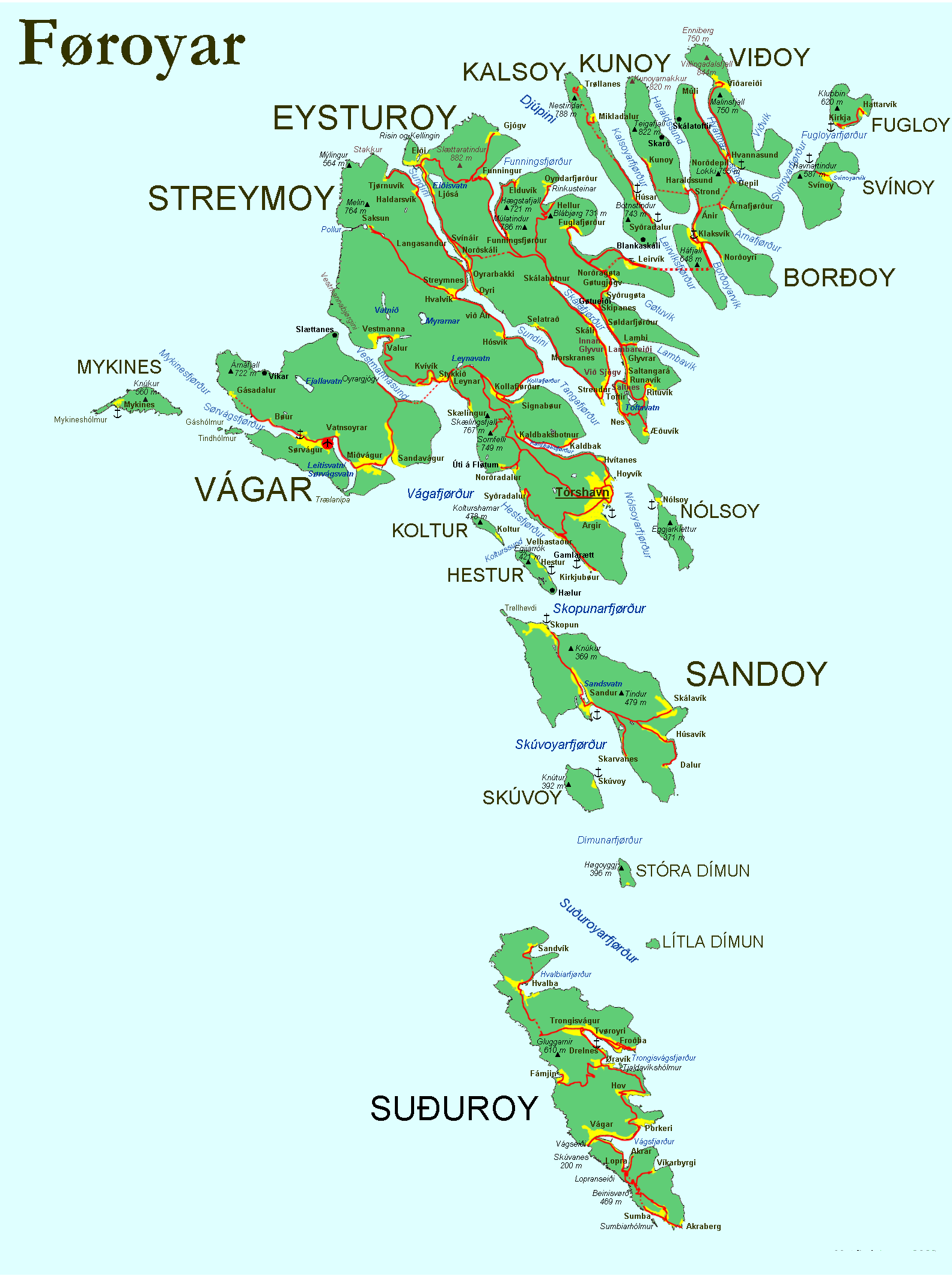
File: Faroe map with villages, streets, straits, firths, ferry harbours and major moutains.png
From New World Encyclopedia
Size of this preview: 448 × 600 pixels. Other resolutions: 179 × 240 pixels | 1,584 × 2,121 pixels.
Original file (1,584 × 2,121 pixels, file size: 370 KB, MIME type: image/png)
File history
Click on a date/time to view the file as it appeared at that time.
| Date/Time | Thumbnail | Dimensions | User | Comment | |
|---|---|---|---|---|---|
| current | 22:13, 24 October 2007 | | 1,584 × 2,121 (370 KB) | Griffin Anglin (talk | contribs) | [http://en.wikipedia.org/wiki/Image:Faroe_map_with_villages%2C_streets%2C_straits%2C_firths%2C_ferry_harbours_and_major_moutains.png source and rights] |
You cannot overwrite this file.
File usage
The following page uses this file: